
GIS-Based Decision Support System and Analytical Hierrachical Process for Integrated Flood Management
Keywords:
Web-GIS, QGIS, DSS, AHP, Mitigation strategiesAbstract
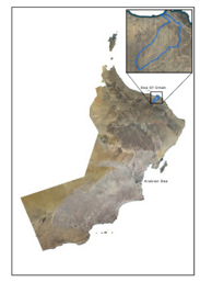
Massive flood losses have prompted initiatives to reduce flooding all around the world. Flood risk assessment methods that are widely used nowadays include remote sensing and Geographic Information Systems (GIS). Both of these systems provide integrated models for analyzing flood risk. Web-based geographic information systems are superior to desktop GIS for doing real-time analyses of flood risk. The Wadi Aday Basin in Oman is going to be evaluated using a web-based geographic information system (GIS), which is the purpose of this project. Cities, location, census statistics, land use and land cover, road network, structures, flood risk management, wadi spread, geomorphology, and the boundaries of the study region are all things that will be discussed. Features such as zooming in and out, measuring features, managing layers, adjusting the level of transparency, and querying geographical data are all provided. A QGIS web-based GIS was designed for the Wadi Aday Basin in the Sultanate of Oman to evaluate and map the regions prone to flooding. The analytical hierarchical process (AHP) technique was applied where it provides a systematic approach for combining the impact of multiple thematic levels to obtain qualitative and quantitative information on successful mitigation of flood risks. The specifics of this information are explained in the article. In order to create a comprehensive Flood Risk Map, the relevant thematic data are brought together in a GIS setting. The AHP approach is used to calculate the flood hazard index, and this index not only takes into account the likelihood that each location will be flooded, but it also takes into account the overall influence that each of the themes has on the flood risk zonation.
Downloads
References
Abdalla R. (2009). Distributed GIS approach for flood risk assessment. International Journal on Advances in Security, 2(2&3), 1.
Abdrabo, K. I., Kantoush, S. A., Saber, M., Sumi, T., Habiba, O. M., Elleithy, D., & Elboshy, B. (2020). Integrated methodology for urban flood risk mapping at the microscale in ungauged regions: A case study of Hurghada, Egypt. Remote Sensing, 12(21), 3548. https://doi.org/10.3390/rs12213548.
Alexander, J., Fielding, C. R., & Pocock, G. D. (1999). Flood behaviour of the Burdekin River, tropical north Queensland, Australia. Geological Society, London, Special Publications, 163(1), 27–40. https://doi.org/10.1144/GSL.SP.1999.163.01.03
Antofie, T., Doherty, B., & Marin-Ferrer M. (2018). Mapping of risk web-platforms and risk data: Collection of good practices. EUR 29086 EN, Publications Office of the European Union, Luxembourg.
Aye, Z. C., Jaboyedoff, M., Derron, M. H., & Van Westen, C. J. (2015) Prototype of a web-based participative decision support platform in natural hazards and risk management. ISPRS International Journal of Geo-Information, 4(3), 1201–1224. https://doi.org/10.3390/ijgi4031201
Deckers, J., Vandenberghe, N., Lanckacker, T., & De Koninck, R. (2015). The Pyrenean inversion phase in northern belgium: An example of a relaxation inversion? International Journal of Earth Sciences: Geologische Rundschau, 105(2), 583–593. https://doi.org/10.1007/s00531-015-1189-8
Eleni, K., Ioannis, F., Alexandros, K., Emmanouil, A., & Konstantinos, N. (2011). Flood hazard assessment based on geomorphological analysis with GIS tools-The case of Laconia (Peloponnesus, Greece). GIS Ostrava, Ostravia. http://gisak.vsb.cz/GIS_Ostrava/GIS_Ova_2011/sbornik/papers/Karagiozi.pdf
Global Facility for Disaster Reduction and Recovery (GFDRR) Annual Report 2011. (2011). Building Resilience to Disasters — Delivering Results. https://www.gfdrr.org/sites/default/files/publication/annual-report-2011.pdf
Haidu, I., & Nicoară, M. E. (2011). GIS procedure for the identification of existing infrastructure in the flooding areas. Geographia Technica, 6, 30–34.
Huang, X., Wang, C., & Li, Z. (2018). Reconstructing flood inundation probability by enhancing near real-time imagery with real-time gauges and tweets. IEEE Transactions on Geoscience and Remote Sensing, 56(8), 4691–4701. https://doi.org/10.1109/TGRS.2018.2835306
Klemešová. K. (2014). Using GIS in the flood management – Flood maps, (Troubky, Czech Republic). Geographia Technica, 9(2), 44–53.
Kourgialas, N. N., & Karatzas, G. P. (2011). Flood management and a GIS modelling method to assess flood-hazard areas-a case study. Hydrological Sciences Journal, 56(2), 212–225. https://doi.org/10.1080/02626667.2011.555836
Mioc, D., Anton, F., & Liang, G. (2008). On-line street network analysis for flood evacuation planning. Remote Sensing and GIS technologies for monitoring and prediction of disasters. Springer.
Ministry of Regional Municipalities and Water Resources (MRWR). (2009). Wady Aday Flood Protection Dams. Muscat. Sultanate of Oman.
Open MI O. 2.0. (2014). OGC open modelling Interface (OpenMI) Interface standard. Open geospatial consortium interface standard. https://www.ogc.org/standards/openmi
Panda, P. K. (2014) Vulnerability of flood in India: A remote sensing and GIS approach for warning, mitigation and management. Asian Journal of Science and Technology, 5(12), 843–846.
Salleh, Siti Aekbal; Abd Latif, Zulkiflee and Che Dom, Nazri (2021). Geospatial Technology in Sustainable Cities and Communities: Introduction to the Special Issue," International Journal of Geospatial and Environmental Research: Vol. 8: No. 2, Article 6: https://dc.uwm.edu/ijger/vol8/iss2/6
Samela, C., Albano, R., Sole, A., & Salvatore M. (2018). A GIS tool for cost-effective delineation of flood-prone areas. Computers, Environment and Urban Systems, 70, 43–52. https://doi.org/10.1016/j.compenvurbsys.2018.01.013
Sterlacchini, S., Zazzeri, M., Cappellini, G., Pastormerlo, M., & Bonazzi, A. (2017). An Open source GIS-based tool for economic loss estimation due to flood events. PeerJ Preprints, 5, e2228v2. https://doi.org/10.7287/peerj.preprints.2228v2
Swain, K. C., & Singha, C. (2020). Flood susceptibility mapping through the GIS-AHP technique using the cloud. ISPRS International Journal of Geo-Information, 9(12), 720. https://doi.org/10.3390/ijgi9120720
Tanavud, C., Yongchalermchai, C., Bennui, A., & Densreeserekul, O. (2004). Assessment of flood risk in Hat Yai municipality, southern Thailand, using GIS. Journal of Natural Disaster Science, 26(1), 1–14. https://doi.org/10.2328/jnds.26.1
Waugh, P. D., Eisel, L. M., Bonner, M. R., editors. Flood control and floodplain planning for the Havasupai Indian reservation. Civil Engineering Database. ASCE, Virginia. https://cedb.asce.org/CEDBsearch/record.jsp?dockey=0093243
Wicht, M., & Osinska-Skotak, K. (2016). Identifying urban areas prone to flash floods using GIS preliminary results [Preprint]. Hydrological Earth System Sciences. https://doi.org/10.5194/hess-2016-518
QGIS. (n.d.). QGIS - A Free and Open Source Geographic Information System. https://www.qgis.org
Zar Chi Aye, Teresa Sprague Vivian, Juliette Cortes Kathrin, Prenger-Berninghoff Michel Jaboyedoff Marc-Henri Derron.2015. A collaborative (web-GIS) framework based on empirical data collected from three case studies in Europe for risk management of hydro-meteorological hazards. International Journal of Disaster Risk Reduction. https://doi.org/10.1016/j.ijdrr.2015.12.001
Downloads
Published
How to Cite
Issue
Section
License
Copyright (c) 2023 Salim Mohammed Al-Waili, Zulkiflee Abd Latif, Siti Aekbal Salleh

This work is licensed under a Creative Commons Attribution-ShareAlike 4.0 International License.
All papers should be submitted electronically. All submitted manuscripts must be original work that is not under submission at another journal or under consideration for publication in another form, such as a monograph or chapter of a book. Authors of submitted papers are obligated not to submit their paper for publication elsewhere until an editorial decision is rendered on their submission. Further, authors of accepted papers are prohibited from publishing the results in other publications that appear before the paper is published in the Journal unless they receive approval for doing so from the Editor-In-Chief.
IJISAE open access articles are licensed under a Creative Commons Attribution-ShareAlike 4.0 International License. This license lets the audience to give appropriate credit, provide a link to the license, and indicate if changes were made and if they remix, transform, or build upon the material, they must distribute contributions under the same license as the original.


